Hurricane Irma is now taking aim at Florida and the West Coast
Video news coverage comes from WFLA TV NewsChannel 8 our Bay Area Livestream partner through Monday afternoon. Now we thank CNN and Fox News for their streams following the storm.
6 PM SUNDAY
Forecasters are now waiting for Hurricane Irma will hit the heavily populated Tampa-St. Petersburg area by about 2 am Monday morning. The winds will be around 115 mph along with a strong storm surge.
Forecasters are not yet sure if Irma will make it back up to a Category 3 Hurricane or if it will stay a strong Category 2 storm. Either way, it will be a major event in the Bay area, late tonight.
The 400-mile-wide (640-kilometer-wide) storm blew ashore in the morning in the mostly cleared-out Florida Keys and then began a slow march up the state’s west coast. But even at this point as far north as Jacksonville, high winds with massive waves that are blasting north Florida.
5 PM SUNDAY
Hurricane Irma is leaving Naples being weakened to a Category 2 storm, technically losing its major hurricane status, after making landfall in southwestern Florida. It is hugging the coast as it moves north to Tampa Bay.
The National Hurricane Center said Irma’s winds were at 110 mph (177 kph), just below major hurricane status, as the center of the still dangerous and wide storm moved farther inland late Sunday afternoon. It was smacking Naples after coming ashore in Marco Island at 3:35 p.m.
The hurricane center says “although weakening is forecast, Irma, but there is still a chance to regain the Category 3 status, but it even if it stays a Category 2 storm, Irma is expected to remain a hurricane at least through Monday morning.”
The center says the eye of Irma should hug Florida’s west coast through Monday morning and then push more inland over northern Florida and southwestern Georgia Monday afternoon.
4 PM SUNDAY
Hurricane Irma made landfall on Marco Island, Florida, as a Category 3 hurricane. The National Hurricane Center in Miami said Irma’s powerful eye roared ashore at Marco Island just south of Naples with 115-mph (185-kph) winds, for a second U.S. landfall at 3:35 p.m. Sunday.
Category 3 storms have winds from 111 to 129 mph, but 130-mph (21-kph) wind gust was recently reported by the Marco Island Police Department.
Irma’s second U.S. landfall was tied for the 21st strongest landfall in the U.S. based on central pressure. Irma’s first U.S. landfall in the Florida Keys was tied for 7th
2 PM SUNDAY
Rain bands with strong winds are starting to hit the Tampa Bay area. Hopes are that power will hold steady as Hurricane Irma takes aim at Tampa around 2 am Monday morning.
Florida Power & Light says it will be weeks, not days, before electricity is fully restored because of the damage being done by Hurricane Irma.
Spokesman Rob Gould said Sunday that an estimated 3.4 million homes and businesses will lose power once the worst of Irma reaches the Florida mainland. He expects thousands of miles (kilometers) of poles and lines will need to be replaced, particularly on the Gulf coast. As of Sunday afternoon, about 1.5 million customers were without power.
He said 17,000 restoration workers from as far away as California and Massachusetts are already stationed around the state, but it will take time to rebuild the system.
The utility covers much of the state, including most cities on the Atlantic coast and the Gulf coast south of Tampa. It does not cover Tampa and St. Petersburg, two major cities in Irma’s forecast path.
12 NOON SUNDAY
All counties in the greater Tampa Bay area is now under a Tornado Watch until midnight tonight. Irman is expected to make land in the Bay Area around 2 am Monday morning or so.
The National Hurricane Center says Category 4 Hurricane Irma is now “headed for the southwest Florida coast” as winds continue to pick up speed in all of South Florida.
Irma continues to be armed with 130 mph winds as its large eye passes north of the Keys.
Storm surge is forecast for 10 to 15 feet in southwestern Florida.
Winds are now at over 40 miles per hour in the Tampa Bay area.
It is the first time that Atlanta has been included in a Tropical Storm alert.
Hurricane-force winds are continuing throughout southern Florida, including the Keys. The hurricane center warns that winds affecting upper floors of high-rise building will be much stronger than at ground level.
The hurricane center also emphasizes that Irma will bring life-threatening wind to much of Florida regardless of the exact track of its center.
8 AM SUNDAY MORNING
The Tampa Bay area remains a target as Hurricane Irma rolls through the Florida Keys and heads up the West Coast. The time will likely be around 2 am Monday morning and Irma will do its biggest damage by 10 am. Then the rain and surge of water will become a very dangerous subplot to Irma.
By early evening all of the Bay Area bridges will be closed because of winds and flodding issues.
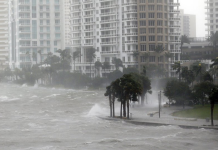
Flood waters are a concern in both Hillsborough and Pinellas County as the storm surge is expected to be a massive problem.
Monday tides along the West Coast from Sarasota north to the Tampa – St. Petersburg COULD be over FOUR TO AS MUCH AS TEN FEET on Monday morning through the late afternoon tides.
At this moment forecasters say Hurricane Irma’s center is poised to blow across the Florida Keys.
The entire state of Florida from the Keys to Jacksonville will be under a tornado watch for the next 24 to 36 hours.
The northern eyewall of the storm reached the island chain early this morning.
The U.S. National Hurricane Center said in a public advisory that the center of the storm remained offshore but was going to make landfall soon. The storm was centered about 20 miles east (30 km) of Key West, and it was moving north-northwest at 8 mph (13 kph)
The storm had maximum sustained winds of 130 mph (215) kph. The National Weather Service reported wind gusts of 90 mph (145 kph) near its Key West office.
After hitting the Florida Keys, Irma was forecast to move up the state’s Gulf Coast later Sunday.
The National Weather Service in Miami has issued tornado warnings for a wide swath of Monroe, Miami-Dade and Broward counties in South Florida.
Officials say the band of rain and tornado producing cells is moving quickly.
There have been no reports of tornadoes touching down.
7:50 a.m.
Authorities are urging people who chose to ride out Hurricane Irma in the Florida Keys to remain indoors until the storm passes.
The storm’s eyewall reached the chain of islands Sunday morning. The National Weather Service reported wind gusts of 90 mph (145 kph) near its Key West office.
In a Facebook post early Sunday, Key West Police urged people who stayed for the hurricane to remain where they took shelter until the storm had passed completely. They also urged people not to go outside when the eye of the storm is over there area, a time period when conditions can seem deceptively calm.
John Huston, who is riding out the storm from his home in Key Largo in the upper Keys, says the wind gusts are strong in his area.
“Water level is higher today,” he said via text message Sunday morning. “Incredible wind that won’t stop.”
11:30 PM – SATURDAY NIGHT
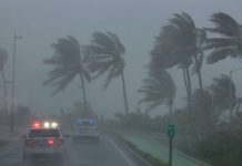
Hurricane Irma’s leading edge bent palm trees and spit rain as the storm swirled toward Florida with 120 mph winds Saturday on a projected new track that could expose Tampa — not Miami — to a direct hit.
Tampa has not taken a head-on blow from a major hurricane in nearly a century.
An estimated 70,000 Floridians huddled in shelters as Irma closed in on the Florida Keys, where it was expected to roll ashore Sunday morning and begin making its way up the state’s west coast.
“This is your last chance to make a good decision,” Gov. Rick Scott warned residents in Florida’s evacuation zones, which encompassed a staggering 6.4 million people, or more than 1 in 4 people in the state.
Earlier in the day, Irma executed a westward swing toward Florida’s Gulf coast that appeared to spare the Miami metropolitan area of the catastrophic direct hit that forecasters had been warning of for days.
Still, Miami was not out of danger. Because the storm is 350 to 400 miles wide, forecasters said the metro area of 6 million people could still get life-threatening hurricane winds and storm surge of 4 to 6 feet.
Irma — at one time the most powerful hurricane ever recorded in the open Atlantic — left more than 20 people dead across the Caribbean as it steamed toward the U.S.
7 PM SATURDAY NIGHT UPDATE
The Tampa Bay area is now in the in the sights of Hurricane Irma. At the moment Irma is making its slow fateful right turn that will put it on a collision course with Florida’s west coast. Sunday as forecasts are locking in on a path that includes the Keys, southwestern Florida and the Tampa Bay region.
The latest hurricane center forecast — which still can change a bit and has a margin of error of dozens of miles — projects Irma’s potent eye to wash ashore three times in Florida: The Keys, around Fort Myers inland to Tampa and then out to open Gulf of Mexico waters briefly before returning inland, north of Homosassa Springs.
The forecasts even have it at hurricane strength well into Georgia on Monday.
For decades, disaster officials and meteorologists have put the Tampa region as one of their worst-case scenarios, along with Miami, New Orleans, Houston and New York. The other four cities have been hit in the last 25 years but Tampa has not been hit by a major hurricane since 1921 when its population was about 10,000, Feltgen said. Now it has around 3 million people.
“It’s certainly one of those metropolitan areas where we have one of the greatest concerns, particularly with storm surge, particularly with inexperience,” Feltgen said.
NOON SATURDAY UPDATE
The Tampa Bay Area is under a Hurricane Warning as Irma begins to take aim at Florida over the next 48 hours. The storm is so large the entire state will feel at least some of Irma’s power.
After Hurricane Irma began pounded northern Cuba, early this morning the storm has been – for the moment- been downgraded to a Category 3. However, once it clears Cuba, Irma, is expected to pick up steam as it heads northwest to land fall in Florida near the lower west coast of the state.
The most powerful Atlantic storm in a decade now has the Fort Myers – Naples in its sights with Sarasota and Tampa expected to get blasted by Irma as well.
A total of 5.6 million people, equivalent to 25 percent of the state’s population, were ordered to evacuate Florida, according to the Florida Division of Emergency Management.
Experts are warning the whipping 130 miles per hour winds have gained so much momentum they could still reach both coasts.
Irma is “an extremely dangerous major hurricane, and will bring life-threatening wind impacts to much of the state regardless of the exact track of the center,” according to the National Hurricane Center.
8 AM UPDATE
As of 8 a.m., Hurricane Irma continues to take aim at the west coast of Florida as a low-end Category 3 hurricane with winds now at 130 mph.
At this hour Irma is located about 10 miles northwest Caibarien, Cuba, and about 225 miles south of Miami and is moving west-northwest at 12 mph.
The latest from the National Weather Service has Hurricane Irma is now heading for Florida’s West Coast. Sunday night the Tampa Bay area is very likely to feel hurricane force winds all the way north to Hernando County.
Winds and high tides due to storm surge in the Bay Area could happen Monday afternoon between three and six feet. That could cause serious flooding both in St. Petersburg and Tampa, even inland.
As of this morning, the National Weather Service said that damaging winds from Hurricane Irma are moving into south Florida, including Key Biscayne, Coral Gables, and South Miami. Gusts of up to 56 mph (90 kph) were reported on Virginia Key off Miami as the storm’s outer bands arrived.
Gusts of up to 56 mph (90 kph) were reported on Virginia Key off Miami as the storm’s outer bands arrived. At present Irma’s center is still about 245 miles (395 kilometers) southeast of Miami as it crosses over the northern coast of Cuba.
The latest forecast track predicts the center of the storm will move along Florida’s Gulf Coast through Monday.
As of this morning, more than 6 million people in Florida and Georgia were warned to leave their homes. The Wind speeds early this morning were about 155 mph.
Puerto Rico, the Dominican Republic and the eastern part of Cuba reported no major casualties or damage by mid-afternoon Friday after Irma rolled north of the Caribbean’s biggest islands.


