Friday morning, The National Hurricane Center issued a new path for Hurricane Irma. The storm has shifted west and will likely go straight up Florida. The good news is it is going to weaken to probably a category two by the time it hits Central Florida.
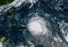
Irma’s sustained winds are now down to 150 mph making it a category four hurricane as it heads towards Cuba’s coast. The storm’s hit to Cuba will likely weaken it even more as there has already been a change to the eye wall.
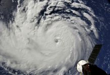
Hurricane Irma just completed an eyewall replacement cycle, and forecasters say the eye continues to widen. That means the diameter of the eye is now nearly 45 miles, which slows the circulation of the storm even more.
Fox 13’s Paul Dellegatto described the widening of the eye as a figure skater spinning. When the figure skater pulls her arms in closer to her body, she spins faster, but as her arms extend away from her body, her spin slows.
While Irma is decreasing in strength, new models show the storm will move straight up Florida and will likely only be a category two by the time it reaches Central Florida Sunday night.

Irma is expected to hit Cuba and the Bahamas Friday through Saturday and make landfall in South Florida Saturday.
The storm’s center is located about 55 miles northwest of Great Inagua Island, about 500 miles away from Miami. It is moving west-northwestward at about 16 mph.
Hurricane warnings have been issed for parts of Florida including, Jupiter Inlet southward from the peninsula to Bonita Beach, the Florida Keys, the Bahams, the Turks and Caicos Islands. Warnings have also been issued for the Cuban provinces of Camaguey, Ciego de Avila, Sancti Spiritus and Villa Clara.
A hurricane watch is in effect for Florida from the Jupiter Inlet to Sebastian Inlet, including Bonita Beach to Anna Maria Island. The Cuban provinces of Guantanamo, Holguin, Las Tunas and Matanzas also have a hurricane watch issued.
A storm surge warning has been issued for Jupiter Inlet to Bonita Beach and the Florida Keys.

Governor Rick Scott is still urging Florida residents to take Irma seriously. He warned that the “massive storm” could be more devastating than Hurricane Andrew, which hit Florida 25 years ago.
“I want everybody to understand the importance of this. This is bigger than Andrew,” Scott said in an interview with ABC News’ Robin Roberts.
On Monday Scott declared a state of emergency for Florida. President Trump has declared a state of emergency for Florida, Puerto Rico, and the U.S. Virgin Islands.
I’m urging families to stay vigilant and monitor local weather and news.
— Rick Scott (@FLGovScott) September 7, 2017
“In Florida, we always prepare for the worst and hope for the best, and while the exact path of Irma is not absolutely known at this time, we cannot afford to not be prepared,” Scott said in a statement released late Monday afternoon to CNN. “This state of emergency allows our emergency management officials to act swiftly in the best interest of Floridians without the burden of bureaucracy or red tape.”
On Wednesday morning Irma slammed over the island of St. Martin. The storm’s eye wall butted up against Anguilla at around 8 a.m. with sustained wind speeds of 185 mph and higher. Irma will move north of Puerto Rico and the U.S. Virgin Islands this afternoon not making a direct hit but unleashing strong winds and heavy rain on the islands.
The massive storm killed at least ten people and injured 23 in French Carribean island territories while destroying over 90 percent of Barbuda. Electricity was knocked out a day earlier to more than one million customers in Puerto Rico.
Heart dropping first photos of the destruction left behind from Hurricane #Irma in St. Martin from the family of PJ2BR-Brett Ruiz. #Prayers pic.twitter.com/3VRazCCXHL
— Chris Bouzakis (@BouzakisWX) September 6, 2017
The National Hurricane Center will continue updating forecast cones every six hours at 5 a.m., 11 a.m., 5 p.m., and 11 p.m.
Tropical storm winds are likely to arrive in the FL Keys and south FL Saturday. Preparations should be rushed to completion. #Irma pic.twitter.com/eto2KVWtgP
— NHC Atlantic Ops (@NHC_Atlantic) September 8, 2017
Follow NHC Atlantic Ops for intermediate advisories.


