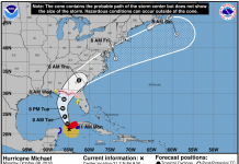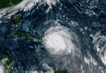
Tropical Depression 16 developed into Tropical Storm Nate early this morning near the coast of Nicaragua.
Nate has sustained winds of 40 mph with some gusts being recorded even higher. Right now a tropical storm warning is in effect for portions of Nicaragua and Honduras. The National Hurricane Center predicts up to 30 inches of rain will be dumped on Nicaragua.
Tropical Storm #Nate has formed with a notable westward forecast shift since yesterday. Check the latest forecast: https://t.co/tW4KeGdBFb pic.twitter.com/D4vkL3S1Ye
— NHC Atlantic Ops (@NHC_Atlantic) October 5, 2017
Models are showing a new westward shift in the track of Nate, which lessens the impact it will have on the Bay Area and Central Florida. Forecasters say the west coast of Florida will still experience high rain chances and gusty winds from the storm though.
It is also still unclear whether Nate will make landfall as a tropical storm or hurricane. The expected landfall path will be somewhere between southeast Louisiana and the Florida Panhandle on Sunday.
The storm will move through the Gulf of Mexico where it could strengthen before making landfall.
Here are the key messages for Tropical Storm #Nate for Advisory 5. Full advisory: https://t.co/tW4KeGdBFb pic.twitter.com/XEdAID7grp
— NHC Atlantic Ops (@NHC_Atlantic) October 5, 2017
Residents of the Florida Panhandle should continue to watch Nate’s progress and should prepare for a hurricane now rather than later. Be sure to have a hurricane kit ready in case the storm shifts back east like many models initially predicted.
This storm has the potential to become a hurricane and impact the Florida Panhandle this weekend, and families must be ready.
— Rick Scott (@FLGovScott) October 5, 2017


